LOT 170
7th August 2013
1/1

Place a bid
You’ll need to sign in to place a bid or add this to your wishlist
Not yet registered? Click here
Condition Report X
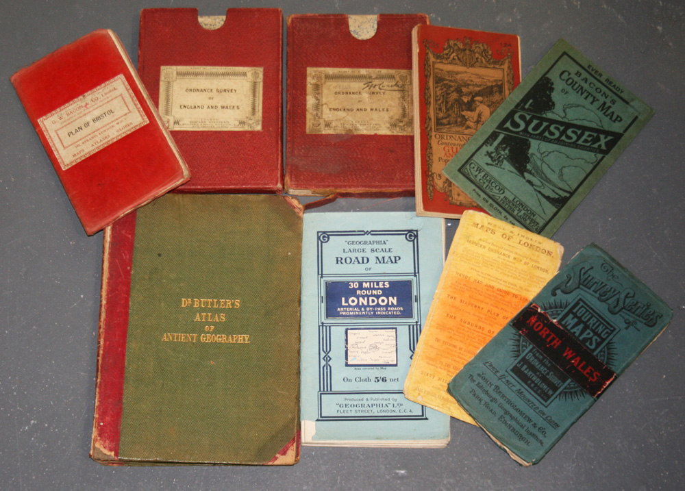
LOT 170
Edward Stanford (publisher) - 'Ordnance Survey of England and Wales' (Map of Part of Sussex from East Wittering to Brighton), mid-19th Century engraving, printed in 32 sections and backed onto linen, approx 66cm x 97cm, folding within original case, together with seven further folding maps and an incomplete 'Dr Butler's Atlas of Ancient Geography'.
Hammer price: £30
( Plus
Buyer’s Premium
)Buyer’s Premium is an additional charge on each lot sold, currently this is set at 24.5% plus VAT (29.4% including VAT) of the hammer price.
All sold prices shown exclude Buyer’s Premium
Condition Report
There is no condition report for this lot.