LOT 8
15th May 2013
1/1
Place a bid
You’ll need to sign in to place a bid or add this to your wishlist
Not yet registered? Click here
Condition Report X
LOT 8
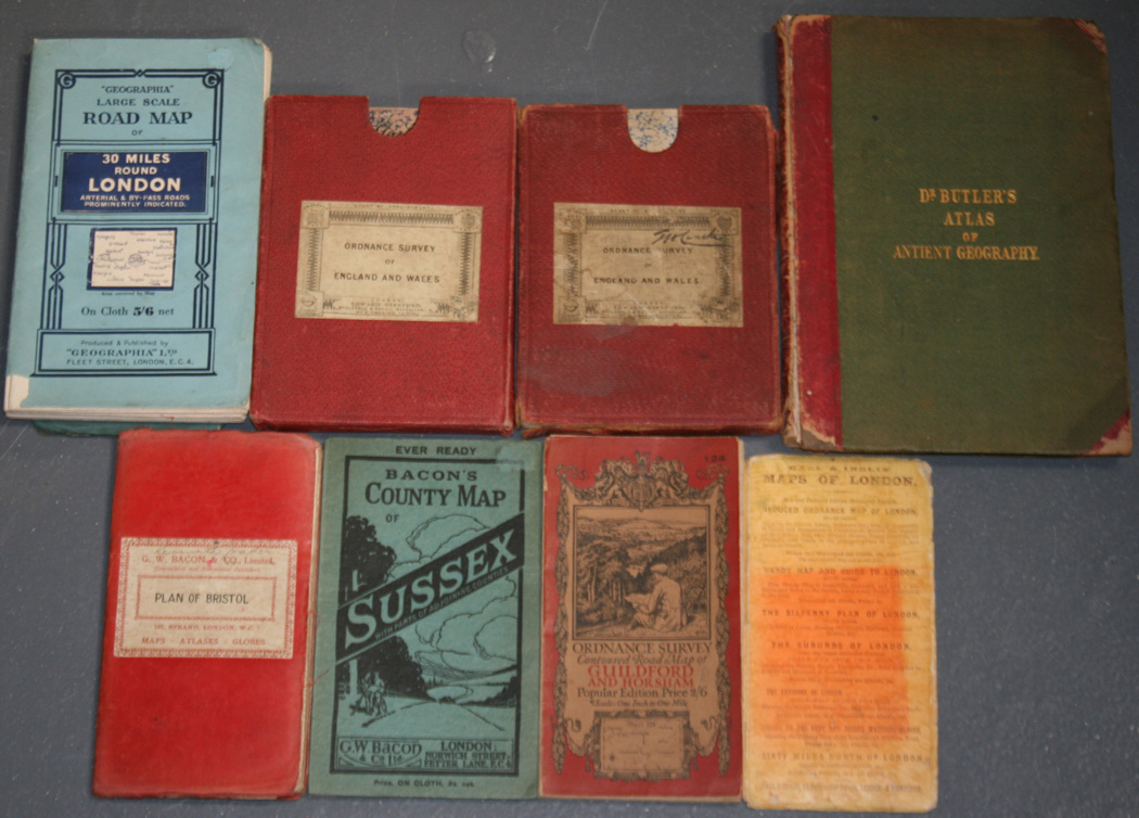
Edward Stanford (publisher) - 'Ordnance Survey of England and Wales' (Map of Part of Sussex from East Wittering to Brighton), mid-19th Century engraving, printed in 32 sections and backed onto linen, approx 66cm x 97cm, folding within original case, together with seven further folding maps and an incomplete 'Dr Butler's Atlas of Ancient Geography'.
Unsold
Condition Report
There is no condition report for this lot.