LOT 1
15th May 2013
1/1
Place a bid
You’ll need to sign in to place a bid or add this to your wishlist
Not yet registered? Click here
Condition Report X
LOT 1
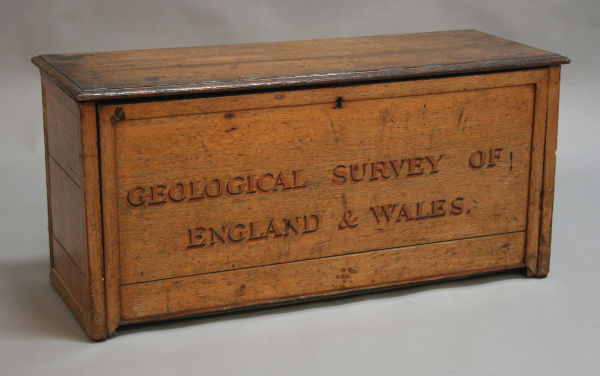
Colonel Thomas Frederick Colby and others - The Ordnance and Geological Survey of England and Wales, 110 hand-coloured electrotype folding maps and an index, printed in sections and backed onto linen, published circa 1868, various sizes, index approx 131cm x 98cm, within an oak case, the fall front with painted title. Note: this part set includes cartographic and geological maps and lacks sections 10 and 16, but includes both types of section 5.
Hammer price: £1,600
( Plus
Buyer’s Premium
)Buyer’s Premium is an additional charge on each lot sold, currently this is set at 24.5% plus VAT (29.4% including VAT) of the hammer price.
All sold prices shown exclude Buyer’s Premium
Condition Report
There is no condition report for this lot.